Monday, July 26, 2010

Why location privacy matters

I attended The Next HOPE, the 8th installment of the Hackers on Planet Earth conference, last weekend. I've attended "hacker" conferences over the past decade and I've rarely seen  location or geo content with the exception of the war driving contests in the early '00s. I was excited that HOPE had a number of geo related sessions ranging from location privacy to hacking your GPS.


Ben Jackson from Mayhemic Labs presented Locational Privacy and Wholesale Surveillance via Photo Services. Jackson sampled 2.5 million photo links posted to Twitter, Twitpic, YFrog and Sexypeek and retrieved latitude and longitude from the EXIF metadata from 65,000 photos. His message was that users are leaking location information, often with knowing it. To publicize his findings, Jackson established ICanStalkYou.com to let users know that they could be easily located. 


In a similar vein, Paul Vet presented Geotagging: Opting-in to Total Surveillance (video available). His tag line, "One geotag is anecdote, many geotags are data," summarizes his position that information about a person's location (home, work, entertainment) and habits (timing) can be derived from mining their twitter stream. Like Jackson, extracting tweets with key words such as bed, home, TV and extracting the location data could be used to build a profile of a person's home, place of work, and their habits. Even tweets from friends, such as "Playing XBox with @username" adds additional information. Vet used a clustering algorithm to further refine individual coordinates in probable locations.


I also followed the GeoLoco conference via Twitter. Panelists in the Future of Geo-Location Panel responded to predictions collected by Dr. Phil Hendrix, the moderator. Here are two predictions that impact location privacy:


2. Location-awareness will be integral to any mobile app.
The panelists mainly agreed with this statement, with the observation that not all mobile apps will need LBS.
“For me, this is obvious,” Eisnor said. “With increase in precision, we’re moving towards an ecosystem of location-aware devices.”
“We’re going to have way too many devices in 2014; we will need to know where they are,” said GigaOM’s Liz Gannes.
4. Virtually all user-generated content will be geo-tagged.
In Ron’s words, “That’s already happening today,” but some of the panelists had reservations about a totally geo-tagged world.
“We’re going to find situations where location-sharing can be very weird,” Scoble said, noting that a recent deal between Rackspace and NASA could have been discovered before it was announced if observers had been tracking both organization’s locations.
“We’re getting to the point where journalists could know what the intelligence community does,” Liebhold said. 
The attitude of conference attendees (via Twitter) towards location privacy seemed to take a back seat to the business of monetizing location, despite the possibility that location privacy issues could make or break a company.


Another week, another hacker conference. This time Thomas Ryan will be presenting Getting in Bed with Robin Sage; which describes his exercise of creating a fake twenty-something year old woman who worked for Naval Network Warfare Command. Robin Sage was able to collect 300 connections on LinkedIn, 110 Facebook friends, and 141 Twitter followers. Robin Sage was able to view photos with location information from Afghanistan and Iraq in Facebook and Twitter. Sage even received job offers and dinner invitations. More information about Robin Sage is available from darkreading.com.


While the US ponders the release of (six month to years old) information from WikiLeaks. It is worth noting that we might want be looking at social media when it comes to releases of information that endanger operational security in the present day.

Saturday, July 24, 2010

Fixing a bricked Dell Mini 9

The Dell Mini 9 has been sitting on the corner of my desk for several months now, unloved and more importantly uncharged. I'm going on vacation soon and I wanted to bring it along for casual coding instead of  my work notebook. I fired it up with a very dead battery and the Dell Mini failed to recognize the battery - ugly orange LED blinking at me. 


What to do? Forums suggested resetting the bios by unplugging and unplugging the CMOS battery. That didn't work, despite the fifteen minutes I spent unscrewing the 25 or so screws that hold the Dell Mini together.


More searching led to flashing the BIOS to make it recognize the battery. Dell only provides a Windows executable for BIOS upgrades (too bad for you cheap bastard, you bought a Mini with Linux), but the enterprising users at Dell Mini Forums packaged a image with DOS and the BIOS flasher that runs on a USB stick. The package and instructions can be found on the Dell Mini Forums.


The BIOS flasher checks to see if the both the battery and power supply are plugged; if neither one is plugged in, then it exits. Since the battery was unrecognized, the BIOS flasher exited. This is where it the fun begins.  You can make the BIOS flasher ignore the power supply and battery checks by running the BIOS flasher with a /forceit option.


The first time I ran the BIOS flasher, it worked correctly. However, the battery was still unrecognized. I'm a great believer in the maxim, "If it jams, force it. If it breaks, well it wasn't working anyways." So yes, I ran the BIOS flasher a second time, and this time the screen went blank and the Dell Mini would not reboot, despite my frantic poking at the on button.


Fortunately, there are many people much smarter than me who are willing to share their smarts. Instructions for recovering a bricked Dell Mini 9 are available at fosk.it


Sometimes no amount of voodoo and vulcan nerve pinches can recover a thrashed computer, so it seems the only solution is to buy a new battery.

Wednesday, July 7, 2010

2010 Nominations for Sol Katz Award for Geospatial Free and Open Source Software

It's that time of year again, nominations for the Sol Katz Award for GFOSS are open. I am honored to serve on the selection committee and I dug up my notes introducing Sol Katz's legacy at the 2005 MapServer MUM3/EOGEO User Conference (intro by Sol's daughter Shanna):
Sol Katz was born in Sweden and emigrated to the United States at the age of one. He was a US Air Force veteran and earned Masters degrees in Geology and Computer Science. Sol was employed but the Bureau of Land Management in Denver. Sol passed away in 1999 from Non-Hodgkin's Lymphoma and he is survived by his wife Heidi and daughters Shanna and Risa.
Sol was an early pioneer of geospatial open source software. His contributions to FOSS include:
  • a key developer of MOSS (Map Overlay and Statistical System) on Data Generals and later, releasing and maintaining PC MOSS
  • release binaries and source for DEM and SDTS translators
  • reverse engineering the ESRI e00 exchange format and publishing the format
  • maintaining a website with links to web mapping and metadata that provided an invaluable resource to implementors
  • being an active participant on multiple list-servs guiding and mentoring GIS newbies such as me
Sol's contributions help build the nascent open source geospatial community which was a precursor to the many geospatial open source projects and communities of today. The Sol Katz Award for Geospatial Free and Open Source Software commemorates Sol's pioneering efforts.

Nominations for the Sol Katz Award should be sent to SolKatzAward at osgeo.org with a brief supporting statement for the nomination. Nominations will be accepted until 23:59 UTC on August 20th. The OSGeo announcement with more details can be found here.

Sunday, June 6, 2010

The map fades

At Wherecamp 2010, I twittered, "as we extend our senses with sensors the map fades." The idea that maps will eventually become obsolete and affectations for future descendants of steampunk aficionados has been difficult to let go. Mike Liebhold started the idea by asking the question, "is 1:1 scale mapping a reasonable idea" on the geowanking list. This touched off a thread that included David Asbury's response containing a link to quotes that touch on the various facets of the 1:1 map. Quotes from the comedian Steven Wright and writers Jorge Luis Borges and Lewis Carroll highlight the absurdity of such a map; and respondents to the question cited information overload would make such a map impractical.


The answer is simple, there is no map. It's gone. Moving freely through the world without resorting to abstractions of location places a large cognitive burden.  Studies of societies steeped in wayfinding have shown that they have developed acute abilities to distinguish environmental clues and extract meaningful information.  What if you no longer need years of experience to develop wayfinding cognitive abilities? 


Wikitude Drive - Test Drivers Wanted from Wikitude on Vimeo.

Friday, May 28, 2010

Locative Media: A New Augmented Reality Blog

Yep, just like we all need a hole in the head, I'm starting an augmented reality blog. The augmented reality stuff doesn't really fit; well nothing really fits in this curmudgeonly hodgepodge of technology, geospatial, and occasional cello posts.


I've been hoarding the locativemedia.org domain for years, so it's time to put it to good use.  With out further ado: Locatively

Saturday, May 22, 2010

HTC EVO 4G Unboxing

Sprint and Google generously gave attendees of of Google I/O 2010 a HTC EVO 4G smartphone.


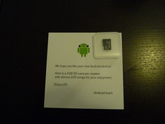
100% recyclable tofu style packaging and a 2GB SD card with 200 songs including Blue Oyster Cult's Godzilla!


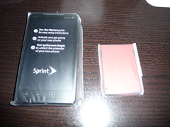
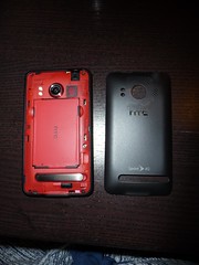
Phone and battery, nice touch with matching battery.


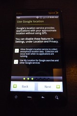
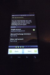
Set up screens for Google location, email, and social media.


Size comparison of devices: iPad, HTC EVO G4, Motorola Droid, iPod Touch, HTC myTouch, Nokia 2610

Sunday, April 25, 2010

Au revoir Dell Mini, bienvenue iPad

It's been mostly fun running OSX on the Dell Mini, but eventually I got tired of using an underpowered system for the type of work that I do.  No amount of tweaking could stop the system from crawling to a halt after several hours. Any and all browsers seemed to consume inordinate amounts of memory and sleep became a game of russian roulette that might require multiple safe boots to reset boot caches.  Compiling took lots of time and running the Android emulator was glacial. I took to dragging around my old 15" MacBook Pro to get things done, but this defeats the purpose of a lightweight travel machine. It was a great experiment because I learned a lot about OSX even though I had been running it for three years before loading it on the Dell Mini. 

The replacement(s) are a MacBook Pro with lots of RAM for running VMs (something the Dell could not do with it's N270 processor) and an iPad.  The MBP is a prosaic machine for doing prosaic things. The iPad does what the netbook is intended to do, except far more elegantly. It's a great media machine with an incredible battery life. It is indeed a great device for consuming media, but its also a good device for capturing media and placing it in your personal catalog of information. I use Evernote to grab web pages, images, pdfs, and to take notes. iPads are inherently social, I've shown the iPad to lots of people by handing it to them and letting the play with it, which is something you can't do with a notebook form factor.  Watching people interact with the iPad made me realize that it is the future UI for the internet of things.

Wednesday, March 31, 2010

Monday, March 29, 2010

Where2.0 and WhereCamp 2010


Where2.0

After deciding to skip Where2.0 and go straight to WhereCamp for 2010, I have to eat my words from twitter describing Where2.0 as, "low signal to noise ratio, unless you count product launches as signal."  Since saying that, the Where2.0 program has proven me wrong and is probably one of the best conference schedules I've seen in a while. 

I'm really excited by the Where2.0 program and I'm having a tough time deciding which session to attend.  I'm happy that all the location based product launches occurred at SXSW, leaving Where2.0 more technically focused this year. Let the marriage of location and real time analytics begin.

That said, I'm also speaking at Where2.0, not once but 3 times.  I'm on two augmented reality panels and an Ignite talk.

Convene and lead a panel on requirements and specifications for an open software stack for augmented reality, based on the assumption that AR is both a discrete medium, and it is the intersection of many media, including web, CAD, mapping, games, virtual worlds... Read more.
This panel will discuss shared augmented realities, considering some of the essential possibilities and challenges inherent in this new class of social augmented experiences. The format is presentation and discussion of a small set of scenarios (defined in advance, with audience input) describing likely future forms of shared augmented realities at differing scales of social engagement. Read more.  
Tish Shute also has more detailed information on our panel session on her blog ugotade.com.
Times are hard and your angel funder just told you that your non-profit open source org needs to feed itself. Great, but it also means change, in terms of process, organization, culture and people's expectations. The talk is about achieving a balance between profitability and the open source mission.
WhereCamp
Since its start in 2007, WhereCamp has taken off with events happening Portland, Denver, Montreal, London, Quebec, and Africa as well as one in the Bay Area following Where2.0.  Google is once again hosting WhereCamp for 2010 and over 240 people have signed up for the event.  There are mentions of kites, cameras, and computers on twitter and Scoble has favorited WhereCamp.  Tish Shute and I are planning a session on the ARWave project which uses the Wave Federation Protocol to deliver augmented reality experiences. There will be camping on the Google grounds promising late night hacking sessions and geo-shenanigans.

Monday, March 22, 2010

Open Source AR Toolkit Roundup (Part 2)

Since the last post on augmented reality toolkits in December, more open source AR projects have been announced.  Without further ado here's a new roundup of AR code to play with.

Locatory is based on the Gamaray open source release and developed at the Open University of the Netherlands.  The project is hosted on Google Code and can be downloaded here.

Mixare is another augmented reality engine for the Android platform. Mixare is a platform to build on and uses json as a data source, lots of good documentation at mixare.org and the code and documentation hosted on Google and available for download.  Mixare based apps are already available in the Android Market Place.

augmentthis! is a server and Android app that let's users upload KML and display them on their Android device.  The server portion is available on Google code. The app is available on the Android Market, and the augmenthis! upload  service is on Google app spot with some additional documentation. 


SLARToolKit brings the venerable ARToolkit code base to Microsoft's SilverLight technology. SLARToolkit can be downloaded from Microsofts open source project hosting site Codeplex.


SLARToolkit - Silverlight Augmented Reality 3D projection sample from Rene Schulte on Vimeo.

Symbian gets its own augmented reality engine with OpenMAR. Source and community for OpenMAR is at their website.

One of the more exciting demos making the rounds around the AR community is the Parrot AR Drone, a quadri-copter controlled by an iPhone.  AR Drone has an open API and SDKs for multiple plaforms available on their site.  


While the following are not complete augmented reality applications, service API and SDKs that support AR applications are also becoming more common place.

Kooaba for both the iPhone and Android platforms provides mobile image search. While not open source, Kooaba provides a free query API and a commercial data upload API. Integrating image search into AR applications is a first step away from static AR content into fully interactive applicaitons.

SNAP or Sensor Networking Application Platform is an Android toolkit developed by Ericsson Labs that provides a uniform API for accessing sensors on Android devices. Interestingly, they choose to use the Open Geospatial Consortium SensorML specification to encode sensor information, can you say "Internet of things?"